Aravalli Hills Supreme Court Ruling: 5 Key Facts on Mining, Protests & Protection - Telecast Global
Table of Contents
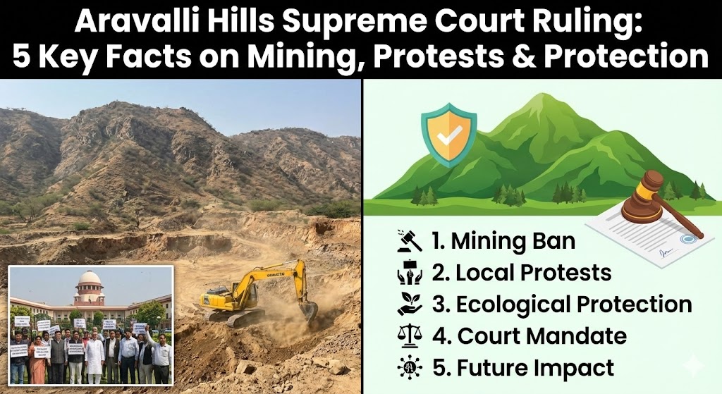
Aravalli Hills Supreme Court ruling has triggered nationwide protests, political debate, and renewed concern over the future of India’s oldest mountain range. The November 2025 judgment redefined how the Aravalli Hills are legally identified, sparking fears that large areas could be opened to mining. Environmental activists, local communities, and opposition leaders argue the ruling weakens protection, while the government insists it strengthens conservation through scientific mapping and uniform rules. As confusion, misinformation, and public anger collide, the controversy has become a critical test of India’s environmental governance, balancing development needs with the urgent responsibility to protect fragile ecosystems.
Why the Aravalli Hills Supreme Court Ruling Redefined the Mountain Range
The Supreme Court of India didn’t wake up one fine morning in 2025 and randomly decide to redraw the map of the Aravalli Hills. This move was a long time coming — driven by legal confusion, uneven state policies, rampant illegal mining, and years of environmental litigation that exposed a basic problem: India never had one clear, scientific, and enforceable definition of what actually counts as the Aravallis.
For decades, different states treated the same mountain range differently. Rajasthan followed a relatively strict definition based on a 2002 expert report, using measurable “local relief” criteria to identify hills and ban mining. Meanwhile, Haryana, Delhi NCR, and parts of Gujarat operated with vague or inconsistent classifications. The result? Mining bans in one district and stone crushers running full throttle just across the border. Environment law turned into a postcode lottery.
This inconsistency became a legal nightmare. Multiple public interest litigations flagged how miners exploited loopholes by arguing that certain hillocks, ridges, or slopes didn’t technically qualify as “hills.” Courts were flooded with disputes over contour lines, elevation data, and land-use records. Even enforcement agencies struggled because what was “protected” on paper wasn’t clearly marked on maps. The Supreme Court realised that without a uniform, objective, and map-verifiable definition, protection orders were basically toothless.
Another big trigger was illegal mining. The Court has repeatedly called unregulated mining in the Aravallis a “grave threat” to India’s ecology. These hills act as a natural barrier against the Thar Desert, recharge groundwater, and serve as green lungs for some of the most polluted urban regions in the country. Yet enforcement reports showed that vague definitions made it easier for illegal operators to challenge penalties and reopen shut mines through technical arguments. The Court wasn’t amused.
That’s why, under judicial directions, the Ministry of Environment, Forest and Climate Change constituted a multi-agency expert committee. This panel included state forest departments, geological experts, and mapping authorities. The task was simple but crucial: define the Aravallis using scientific criteria, not political convenience. Elevation thresholds, contour mapping, buffer zones, and ridge connectivity were all brought into a single framework.
The Supreme Court’s intent was also preventive. By clarifying definitions now, the Court aimed to stop future damage rather than merely punish violations after forests are gone and aquifers collapse. It made clear that environmental protection cannot depend on arbitrary interpretations by states or revenue departments. A mountain range that took billions of years to form can’t be safeguarded with ambiguous paperwork.
In short, the Court revisited the definition because confusion was killing conservation. Whether one supports or opposes mining, clarity was unavoidable. This ruling is less about expanding mining and more about ending legal chaos — and finally putting hard ecological boundaries where soft excuses once existed.
Aravalli Hills’ Ecological Importance: More Than Just Ancient Rocks
Calling the Aravalli Hills “just old rocks” is like calling the internet “just wires.” Technically true, massively misleading. These hills are among the oldest geological formations on Earth, but their real value isn’t age — it’s function. Even today, the Aravallis quietly hold together North India’s fragile ecological balance, doing jobs no modern infrastructure can replace.
First up: desert control. The Aravallis act as a natural wall against the eastward expansion of the Thar Desert. Without them, desertification would push straight into fertile plains and urban belts. Environmental studies have consistently warned that weakening this barrier accelerates land degradation, dust storms, and soil infertility across Rajasthan, Haryana, and western Uttar Pradesh. No court order, highway, or plantation drive can quickly undo that kind of damage.
Then there’s groundwater recharge, the most underrated superpower of the Aravallis. These hills slow surface runoff, allowing rainwater to percolate deep into aquifers. Cities like Delhi NCR depend heavily on this recharge, even if they rarely acknowledge it. Destroying hill slopes through mining doesn’t just scar landscapes — it collapses natural water-storage systems. Once aquifers dry up, you don’t “fix” them with policy speeches. You wait decades, if you’re lucky.
Air quality is another big one. The Aravallis are often called the “green lungs” of North India, and that’s not poetic exaggeration. Forested stretches absorb pollutants, trap dust, and moderate local temperatures. As Delhi and nearby cities choke under toxic air, these hills quietly reduce wind-borne dust from arid regions. Strip them bare, and pollution spikes don’t just increase — they explode.
Ecologically, the Aravallis are also a biodiversity corridor. Leopards, hyenas, jackals, birds, reptiles — all use this range as a connected habitat. Fragment the hills, and you fragment wildlife movement. That’s how you get more human–animal conflict, shrinking populations, and eventual local extinctions. Conservation here isn’t about saving cute animals; it’s about maintaining ecological continuity.
The cultural angle matters too. Ancient temples, forts, stepwells, and settlement patterns evolved with the Aravallis, not against them. These hills shaped trade routes, defense strategies, and water systems long before modern states existed. When we damage the Aravallis, we don’t just erase forests — we erase history and traditional ecological knowledge that understood sustainability long before the word became trendy.
This is why the Supreme Court of India keeps stressing that the Aravallis are not optional geography. They are critical natural infrastructure. Treating them like expendable land banks for mining or real estate ignores their systemic role in climate resilience, water security, and public health.
Bottom line: the Aravallis aren’t relics of the past. They’re active defenders of the present — and future. Lose them, and the environmental bill won’t come in instalments. It’ll arrive all at once.
The Mining Fear: What the Protests Are Claiming—and Why
The protests erupting across Rajasthan, Haryana, and the Delhi NCR didn’t come out of nowhere. For environmental activists and local communities, the **Supreme Court of India’s 2025 ruling on the Aravalli Hills set off alarm bells for one core reason: fear of mining expansion disguised as legal clarity.
At the heart of the protests is a powerful claim — that redefining the Aravallis using technical criteria like elevation and contour lines could quietly exclude large tracts of land from protection. Protesters argue that hills under a certain height or with gentler slopes may now fall outside the “official” definition, opening the door to legal mining. In regions already scarred by decades of stone quarrying, even the hint of relaxation feels existential.
A major flashpoint is the widely circulated claim that “up to 90% of the Aravalli area will now be open to mining.” Whether accurate or exaggerated, this number has become a rallying cry. Activists fear that mining companies, armed with survey data and legal teams, will cherry-pick interpretations to revive stalled leases. Given India’s track record with environmental enforcement, skepticism isn’t paranoia — it’s lived experience.
Local communities have their own reasons to be angry. In mining-affected districts, residents link quarrying directly to falling groundwater levels, cracked houses from blasting, loss of grazing land, and rising health problems. For them, the Aravallis aren’t an abstract ecological concept; they’re water, livelihood, and survival. Any legal shift that appears to dilute protection feels like a betrayal.
There’s also deep distrust of implementation. Protesters point out that even under earlier bans, illegal mining flourished due to weak monitoring, political patronage, and regulatory capture. If enforcement failed when definitions were broad, critics ask, how will it succeed now with more technical criteria? The fear is that precision on paper will translate into loopholes on the ground.
Environmental groups are particularly worried about cumulative impact. Mining doesn’t just remove rock; it destroys hill slopes, disrupts wildlife corridors, and permanently alters drainage patterns. Even “small” quarries, when multiplied across a landscape, can dismantle entire ecosystems. Protest leaders argue that once mining starts legally in fringe zones, pressure will mount to expand further inward.
Social media has amplified these anxieties. Hashtags like “Save Aravalli” frame the ruling as a battle between citizens and corporate interests. In a climate where environmental decisions often lack public consultation, the protests reflect a broader demand: transparency, accountability, and proof that conservation truly comes first.
Importantly, many protesters aren’t rejecting development outright. They’re rejecting unchecked development in one of India’s most fragile ecological zones. Their message is blunt: the Aravallis have already paid the price for decades of exploitation. Any ambiguity now could finish the job.
Whether all fears are justified or not is a separate debate. But the protests make one thing clear — trust is low, stakes are high, and when it comes to the Aravallis, people are done giving the benefit of the doubt.
Government’s Clarification: How the New Rules Aim to Strengthen Protection
As protests gained momentum, the Union government stepped in to counter what it called “widespread misinformation” surrounding the **Supreme Court of India’s November 2025 ruling on the Aravalli Hills. The message from the Centre was blunt: the new definition does not weaken protection — it tightens it. And unlike earlier regimes, the government insists this framework leaves far less room for manipulation.
The backbone of this clarification came from the Ministry of Environment, Forest and Climate Change (MoEFCC), which coordinated the expert committee tasked with standardising how the Aravallis are identified. According to the ministry, the problem was never too much protection — it was uneven protection. Different states used different criteria, allowing mining to flourish in administrative grey zones. The new rules, the government argues, shut those grey zones down.
One of the most critical points clarified is the 100-metre local relief rule. The government stresses that this threshold does not isolate only the hilltop. Instead, it legally protects the entire landform — including slopes, foothills, and connected features — by drawing boundaries using the lowest surrounding contour line. In simple terms: if a hill qualifies, everything connected to it qualifies too. This directly challenges the protest narrative that lower slopes will now be exposed to mining.
Another major safeguard is the 500-metre connectivity rule. Hills located within 500 metres of each other are treated as a single Aravalli range, not separate fragments. This prevents miners from exploiting gaps between hillocks to claim legal access. Ecologically, this matters because wildlife corridors, drainage systems, and vegetation don’t respect district boundaries or land records — they function as continuous systems.
Mapping is where the government claims the biggest upgrade. Under the new framework, Aravalli hills and ranges must be clearly marked on Survey of India topographical maps before any mining-related decision can even be considered. This removes subjectivity at the local level and strengthens enforcement against illegal operations. Officials argue that if a site isn’t mapped, it simply can’t be touched.
The government has also highlighted absolute no-mining zones. Protected areas, wildlife corridors, eco-sensitive zones, wetlands, CAMPA plantations, and forest lands remain completely off-limits. These exclusions are automatic — no discretionary approvals, no “case-by-case” dilution. In fact, the Centre maintains that the list of untouchable zones has expanded, not shrunk.
To address enforcement skepticism, the clarification outlines stricter monitoring tools: drone surveillance, GIS-based lease tracking, joint inspections, six-month compliance reporting, and immediate suspension for violations. Repeat offenders face cancellation, penalties, and blacklisting. The government’s pitch is clear — illegal mining is no longer just a paperwork violation; it’s a tech-tracked offense.
Perhaps the strongest reassurance is the temporary freeze on new mining leases. Until a region-wide Sustainable Mining Management Plan is finalised, no new leases will be issued in mapped Aravalli areas. Existing mines must comply with the new rules or shut down. This pause, the government says, proves intent: protection first, exploitation later — if at all.
In short, the government’s clarification reframes the ruling as a structural cleanup. Less ambiguity. More science. Tighter enforcement. Whether this vision survives contact with ground-level realities remains to be seen — but on paper, the protective net around the Aravallis is undeniably tighter than before.
What Happens Next: Sustainable Mining, Conservation, and the Road Ahead
Now that the dust has (mostly) settled on the Supreme Court of India’s 2025 ruling, the real test begins. Court orders don’t protect ecosystems — implementation does. For the Aravalli Hills, the road ahead is a tightrope walk between environmental survival and economic pressure.
The immediate next step is the preparation of a landscape-level Sustainable Mining Management Plan (SMMP) under the supervision of the Ministry of Environment, Forest and Climate Change. This plan is meant to move decision-making away from isolated project approvals toward cumulative impact assessment. Instead of asking, “Can this one mine operate?”, authorities will be forced to ask, “Can this entire ecosystem handle any mining at all?” That shift alone is massive.
Until the SMMP is finalised, the freeze on new mining leases remains in place across mapped Aravalli zones. This pause is crucial. It creates breathing space — for science to catch up, for boundaries to be verified, and for illegal operations to be flushed out. Existing mines aren’t off the hook either. They must comply with stricter environmental norms, real-time monitoring, groundwater safeguards, and restoration obligations. Non-compliance now carries a real risk of shutdown, not just token fines.
Sustainable mining, as envisioned by the Court, isn’t a greenwashed slogan. It comes with hard conditions: limited extraction zones, controlled blasting, mandatory backfilling, slope stabilisation, post-mining afforestation, and continuous environmental audits. In sensitive stretches, the likely outcome is zero mining — not “regulated” mining. This directly addresses activist concerns that sustainability is often used as a loophole rather than a limit.
Conservation efforts are also expected to scale up. The ruling strengthens the legal foundation for expanding eco-sensitive zones, wildlife corridors, and groundwater recharge projects across the Aravallis. Reforestation, soil conservation, and revival of traditional water systems like johads and baoris are no longer optional add-ons; they’re central to long-term resilience, especially in climate-stressed regions like Delhi NCR and eastern Rajasthan.
Technology will play a bigger role than ever. Drone surveillance, satellite imagery, GIS-based mapping, and digital transport tracking are meant to choke illegal mining at its roots. The idea is simple: if you can’t hide extraction, you can’t normalise it. But tech is only as strong as the political will backing it. Without consistent enforcement, even the best systems degrade into box-ticking exercises.
Public vigilance will matter just as much as policy. Local communities, environmental groups, and courts will continue to act as watchdogs. The protests, regardless of where one stands, have already forced transparency into a process that often operates quietly. That pressure is unlikely to disappear — and honestly, that’s a good thing.
The bigger lesson here is philosophical. The Aravallis force India to confront a hard truth: some landscapes are too critical to be treated as resource banks. Development that ignores ecological limits eventually collapses under its own weight — through water crises, pollution, and climate shocks.
The road ahead isn’t clean or simple. But if this ruling is implemented honestly, it could mark a rare win where conservation doesn’t just survive development — it defines it. And for a mountain range older than most life on Earth, that respect is long overdue.